2011-Weather-June
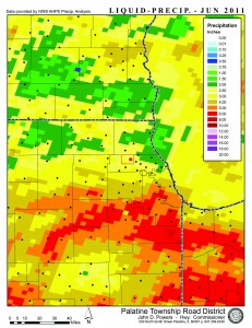
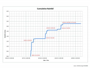
 Coming off the heels of wet months, June tallys 14 measureable rainfall events and will be the 5th wettest June in 84 years. The total amount of precipation measured at O’Hare was 3.39″ however Midway totalled 7.29″. Our monitoring rain gauge calculated 3.27″. Early in the month we had periods of hot and of course humid weather. June provided us with temps that have been hottest since since Aug 2, 2006 with 4 days above 90 degrees mark. If that wasn’t enough June 8th to 9th had the biggest temperature swing in 23 years from a high of 95 degrees to 50 degrees in the afternoon of the 9th. Mid month brought a cool down of sorts but gave way to high winds and a possible tornado through Cook County. An EF1 tornando was spotted from Downers Grove to Mt Prospect with 75-80 mph winds reported along the way. Large swaths of destruction were seen Tuesday evening June 21 due to winds. Five general types of straight line winds are defined as downburst, microburst, gust front, bow echo and derecho. This storm seemed similiar to the “Derecho” of August ’08 when fast moving thunderstorms produce destruction over hundreds of miles. Downburst and gust front winds however seemed to be the culprit for most of the damage.


