Roadway History
 The 1785 Land Ordinance passed under the US Articles of Confederation was intended to provide a means of raising money for the US government through the sale of the land west of the original 13 colonies. Since the area was largely unmapped a system for mapping and subdividing the land had to be devised. The ordinance provided that the land would be divided into 6 mile square townships and that each of the 36 square miles in the township would be divided into land sections containing 640 acres.
The system that was being laid out by the federal surveyors was called the range and township system. It was keyed to the north south meridians and east west base lines and formed a system of 36 square mile townships. Each of the square miles was called a section and contained 640 acres. Sections could be easily divided into parcels of 320, 160, 80 and 40 acres. The US Surveyors of the day laid out each section corner on foot, using 66 foot chains, their transit and a compass while traversing hundreds of miles. Generally one survey crew laid out the township while another one quickly followed and established the corners of the sections. That survey and its documentation became the basis for the sale of these public lands to settlers, speculators and others able to meet the federal requirements for obtaining the land. The rapid development that occurred would have been impossible without this orderly method for distributing the land. Early roads were laid out in what deemed to be the most convenient and eligible routes between terminal points without regard to directness. Natural barriers such as hills and sloughs were avoided and the shallow crossings of creeks and rivers sought.
As the population grew and the government survey lines became more established, the section lines became the choice for most of the roadways. Following the section lines had some advantages and also presented some problems. Towns and schools were most likely to be on a section line and the use of these boundaries generally kept the road from running through the middle of someone’s property. What it did not do was use the experience of the viewers, which were local landowners selected to ensure that the new road served the local farms, avoided poorly drained areas and used the best route for getting their products to town, to avoid land unsuitable for a road. Later on as these roads became more important to the commerce of the state, they had to be maintained to a higher standard. The township and later the county would have difficulty maintaining these straight roads that did not follow high ground and avoid poorly drained land.
…the above text is taken from a report prepared by Andrew Plummer, a Township resident and former employee of Cook County Highway Department.
By 1835 the Native Americans were gone and Easterners began settling the groves. The influx of settlers quickly widened the little trails into roads. Farmers expended tremendous energy improving them. With the creation of township government these efforts became more systematic.
When the citizens of Palatine Township got together for their first annual Town Meeting in 1850 they knew they had a big job to do. They wanted roads built – fast. The Township at that time was covered with rolling prairies sitting atop many feet of rich black soil. The farmers pouring into the area were itching to grow wheat, corn and oats. They wanted to fatten their cattle and hogs and supply milk for a growing Chicago market. But getting that product to market was going to be a challenge.
A couple of muddy paths connected the various groves. Basins of water dotted the western portions of the Township. Swamps and marshland lay to the east and in between small streams drained into Salt Creek. Bridges had to be built, trees cut down, hills scraped and low spots filled in. There were a lot of roads to build and the citizens knew that only a community-wide effort could develop the area.
The Township of Palatine surveyed and straightened out the old “Indian trail roads”. The Township also surveyed and laid out roads along the section lines. In 1853 a road-building fad swept through our area.
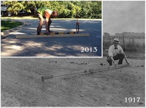
For decades the roads in many places were impassable during rainy spells. This posed a problem for farmers who needed to get their product to market in a timely fashion. By the 1880’s legions of bicyclists were bending their wheels on countryside potholes. The roads really proved to be a hazard when the first automobiles appeared at the tum of the century. Township voters finally approved a hard road tax in 1913. The State of Illinois matched these funds and sent 75 carloads of gravel to the Township.
The State of Illinois created the legal machinery to allow road districts to perform the work. Three Highway Commissioners were elected to build a network of small local roads that would feed into the larger county and state roads. The Township Board carved the Township into nine road districts. Superintending each road district was an Overseer of Highways.
Certain procedures had to be followed before a road could be built. A group of citizens in a district had to sign a petition “praying” (asking) that a road be built. Technical language was used to describe the location of the road. The Board then had to decide whether the benefits of the road outweighed the costs.
Benefits were usually obvious but the farmer who lost acreage to the road had to be paid damages. Sometimes the farmer felt the damages offered were not enough and was allowed to press his case before the Justice of the Peace. Most of the time the Board approved the road and work began in earnest.
After the road was surveyed, the Overseer of Highways was charged with mustering the labor and gathering equipment in his district. Citizens were told that on a given day they would need to show up with wagons and teams of horses and put in twelve hours of hard work. They were given a choice of performing that labor or paying a road tax. Overseers kept track of everything that was done and turned in reports to the Highway Commissioner. This system produced a great number of the roads that we see today.
As road building technology changed, the Road District changed too. In 1874 the number of road districts was decreased from twenty-five to four. 1909 is the last time the Overseer of Highways is mentioned in local records. Two of the three Highway Commissioners were also eliminated in 1917.
A national “good roads” movement encouraged local governments to find better methods and materials. Cook County was a leader in the use of concrete on its roads. Rand Road was paved in 1918 and by 1921 Cook County had laid 235 miles of concrete, more than any county in the nation. Pavements were only sixteen feet wide at first but over the years have been widened and made safer for the motoring public.
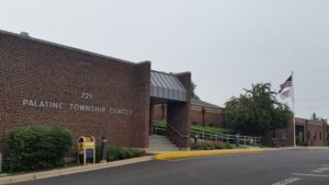
In the 1930’s and 40’s the Road District used a small piece of land on Franklin Street to store its trucks and material. It had a wooden shed on Coolidge Avenue in the 1950’s and 60’s. In 1967 it purchased a large property at 530 N. Smith Street in Palatine, and built a modem garage for its trucks in 1969.
…the above text is taken from a report prepared by David Hammer, a Township resident and Township Historian.


